| North American Regional Climate Change Assessment Program |


| Experiment 0 | ||||||||||||||||||
OverviewThe objective of NARCCAP Experiment 0 is to examine the possible influence of regional climate model domain size and boundary location on simulated meteorological fields in the domain interior. Previous experiments have suggested that regional climate model domains that are too large may allow the climate simulated by the regional model to decouple unrealistically from that of the driving boundary conditions. In contrast, if the domain is too small, the regional model may not have sufficient physical space to fully develop the dominant mesoscale flow features indigenous to the region. Also, if the domain is not optimally located it may not allow for sufficient horizontal space for coupling to remote large-scale forcing features. Experimental DesignThe Regional Climate Modeling Laboratory at Iowa State University will manage Experiment 0. The modeling team will perform a series of 1-year simulations with alternative domains and with boundary conditions supplied by the NCEP/DOE Reanalysis - II (R2) data. Land/ocean distribution and preferred flow directions for meteorological systems suggest that the direction of domain enlargement might make a difference. To allow for this possibility, a series of up to four simulations will be performed, as described below. Each group should perform at least the first two. Each run will consist of a 12-month simulation beginning January 1979. Base Computational Domain
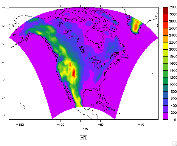
Note that a Lambert conformal conical projection true at 30N and 60N will give a similar domain. The base computational domain with orography is given in Figure 1.
Driving Data FieldsReanalysis data
Driving fields for Experiment 0 are supplied by the NCEP/DOE Reanalysis - II (R2) data. Each modeling group should access the R2 data directly from one of the three sources given below depending on which is more convenient. Each year of R2 data is over 3 GB, so make sure you have enough free disk space before you do the transfer. Sources
Sea Surface Temperature and Sea Ice Considerations when selecting a source for sea surface temperature (SST) and sea ice (SI) include temporal and spatial resolution of the data and consistency with the R2 atmospheric data. SST/SI are obtained by use of the AMIP-II procedure that generated these fields for R2. The only difference is that the NARCCAP boundary conditions are on a 0.5 degree latitude-longitude grid. The data are available in the ISU RCM Lab R2 mirror site. Follow this link to learn more about processing these data. The file naming convention of the AMIP-II SST/SI is illustrated below for data in 1979. Sea Ice: Note: The AMIP-II procedure produces mid-month values of SST/SI, which users of the data need to linearly interpolate in time. Although the linearly interpolated values may not correspond with observed values, the AMIP-II procedure ensures that the monthly averages from observations and the interpolated values will be equal. Procedure From any of these sources the data may be accessed with the following procedure: To save the tedium of clicking on each file, it is better to use the Linux (and Unix?) "wget" command. To do this, first create a file containing the URLs for the files to be fetched. In our case these are the paths behind the links at the ICTP site. For example, to get all the R2 fields for 1999 we can put the following URLs into the list of files to retrieve (we'll imaginatively call this "list"):
ftp://ftp.cdc.noaa.gov/pub/Datasets/ncep.reanalysis2/pressure/hgt.1999.nc ftp://ftp.cdc.noaa.gov/pub/Datasets/ncep.reanalysis2/pressure/rhum.1999.nc ftp://ftp.cdc.noaa.gov/pub/Datasets/ncep.reanalysis2/pressure/uwnd.1999.nc ftp://ftp.cdc.noaa.gov/pub/Datasets/ncep.reanalysis2/pressure/vwnd.1999.nc ftp://ftp.cdc.noaa.gov/pub/Datasets/ncep.reanalysis2/pressure/omega.1999.nc ftp://ftp.cdc.noaa.gov/pub/Datasets/ncep.reanalysis2/surface/pres.sfc.1999.nc ftp://ftp.cdc.noaa.gov/pub/Datasets/ncep.reanalysis2/surface/mslp.1999.nc Terrain and land use Each modeling group will use the terrain and land-use datasets that they have implemented for their model. Description of Individual RunsRun 0.0 Run 0.1 Run 0.2 Run 0.3 ResultsRun 0.0: Precipitation, Maximum Temperature, Minimum Temperature, 500 hPa Height Run 0.1: Precipitation, Maximum Temperature, Minimum Temperature, 500 hPa Height Run 0.2: Precipitation, Maximum Temperature, Minimum Temperature, 500 hPa Height Time Series: Precipitation, Minimum Temperature, Maximum Temperature Datasets to be Saved LocallyModeling groups will want to archive fields for their own use and possibly follow-on science studies springing from Experiment 0. Since we are doing this collective set of domain sensitivity experiments, it would be nice to do an evaluation of what physical processes are most important for the domain sensitivity, should it appear to be important. We suggest that all modeling groups save at their home site as much of their "standard" output as they can for later analysis of this issue. Analysis specifically of the domain sensitivity requires that the following fields be save (at least every 12 hours):
Initial Data to Submit to ArchiveData will be submitted to the RCM Lab's archive at Iowa State University in NetCDF format. There may be a learning curve to climb for those not having previously used NetCDF before, but it seems well worth the effort. The output will be easier to read by external users, particularly in follow-on phases of NARCCAP when we generate scenario output for impacts assessors. The following variables should be included in initial outputs submitted to the RCM Lab:
The reasons for this relatively short initial list are:
TimetableAugust 2, 2004
September 9, 2004
September 22, 2004
October 15, 2004
November 1, 2004
December 10, 2004
December 13-17, 2004
January 1, 2005
January 9-13, 2005
For more information, contact Dave Flory (flory@iastate.edu). |